Show the map
Certified Track - ITRA
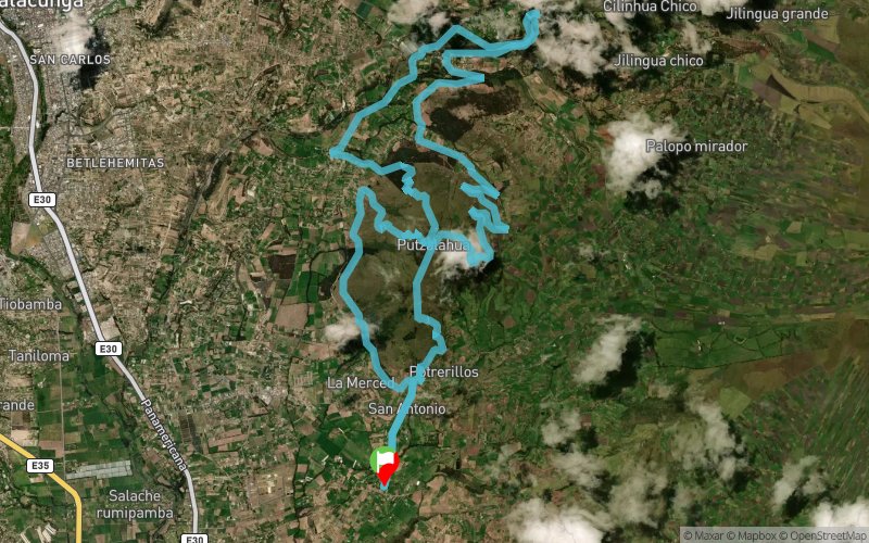
Pu 2016 - Putzalahua Trail Running


 Inconnu (EC)


high technical level, with an actual distance of 32 km walking sections of height with great positive accumulated slope, crossing rivers, waterways, through forests with many nature trails of the Andean plateau.
Points of Interest table
| Accum. | Intermediary | |||||||
|---|---|---|---|---|---|---|---|---|
| POI | Description | Alt. | Dist. | D+ | D- | Dist. | D+ | D- |
 Competition organized on 10/02/2016
Trace n°26145
Ascent threshold : 3 m Distance threshold : 0 m Smoothing : No Origin of altitudes : GPS
Ascent threshold : 3 m Distance threshold : 0 m Smoothing : No Origin of altitudes : GPS
Loop
Dominant terrain : Footpath
Max alti. : 3530 m
Avg alti. : 3085 m
Min alti. : 2812 m
Longest ascent : 740 m
Longest descent : 790 m
Dominant terrain : Footpath
Max alti. : 3530 m
Avg alti. : 3085 m
Min alti. : 2812 m
Longest ascent : 740 m
Longest descent : 790 m
Elevation profile
More tools
Create a new roadbook page
Map and track on your website
Warning ! When you insert a Trace de Trail map on your website, you agree not to hide any element of the module (links to Trail Trail or Trail Connect banner)
Add a realisation
Validate
Add a realisation to share your chrono and describe the conditions that you encountered during you trail running !
Add a comment
Validate
Show the infos
Add a track


