Show the map
OFFICIAL ROUTE
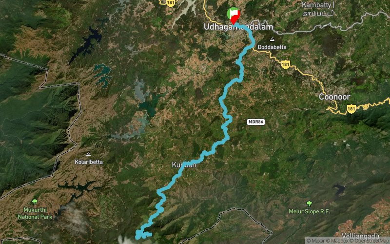
Nilgiris Ultra 2016 - 100 km


 Thuneri (IN)


Fourth edition of the beautiful run in the Nilgiris, Western Ghats region in Tamil Nadu, India. Route passes through tea estates, forest region, sparsely populated villages and rolling hills.
Points of Interest table
| Accum. | Intermediary | |||||||
|---|---|---|---|---|---|---|---|---|
| POI | Description | Alt. | Dist. | D+ | D- | Dist. | D+ | D- |
 Competition organized on 11/12/2016
Trace n°25830
Ascent threshold : 3 m Distance threshold : 0 m Smoothing : No Origin of altitudes : GPS
Ascent threshold : 3 m Distance threshold : 0 m Smoothing : No Origin of altitudes : GPS
Loop
Dominant terrain : Road
Max alti. : 2278 m
Avg alti. : 1977 m
Min alti. : 1619 m
Longest ascent : 320 m
Longest descent : 280 m
Dominant terrain : Road
Max alti. : 2278 m
Avg alti. : 1977 m
Min alti. : 1619 m
Longest ascent : 320 m
Longest descent : 280 m
Elevation profile
More tools
Create a new roadbook page
Map and track on your website
Warning ! When you insert a Trace de Trail map on your website, you agree not to hide any element of the module (links to Trail Trail or Trail Connect banner)
Add a realisation
Validate
Add a realisation to share your chrono and describe the conditions that you encountered during you trail running !
Add a comment
Validate
Show the infos
Add a track


