Show the map
Valmy - Massane - Tour Madeloc
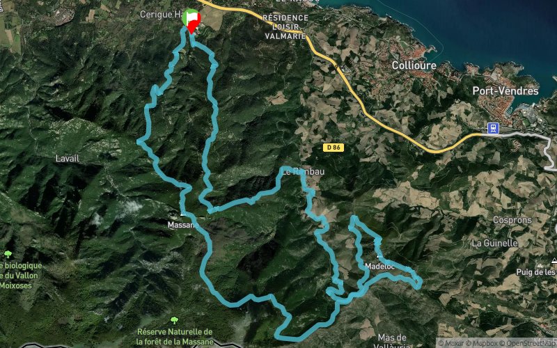


33.1 km
2050 m
2050 m
 Argelers (66)
 Points of Interest table
| Accum. | Intermediary | |||||||
|---|---|---|---|---|---|---|---|---|
| POI | Description | Alt. | Dist. | D+ | D- | Dist. | D+ | D- |
Trace n°24406
Ascent threshold : 3 m Distance threshold : 5 m Smoothing : Yes Origin of altitudes : MNT Aster GDEM
Ascent threshold : 3 m Distance threshold : 5 m Smoothing : Yes Origin of altitudes : MNT Aster GDEM
Loop
Dominant terrain : Footpath
Max alti. : 810 m
Avg alti. : 400 m
Min alti. : 44 m
Longest ascent : 740 m
Longest descent : 490 m
Route completed by the author : nc
Dominant terrain : Footpath
Max alti. : 810 m
Avg alti. : 400 m
Min alti. : 44 m
Longest ascent : 740 m
Longest descent : 490 m
Route completed by the author : nc
Elevation profile
More tools
Create a new roadbook page
Map and track on your website
Warning ! When you insert a Trace de Trail map on your website, you agree not to hide any element of the module (links to Trail Trail or Trail Connect banner)
Add a realisation
Validate
Add a realisation to share your chrono and describe the conditions that you encountered during you trail running !
Add a comment
Validate
Urien Caroline Gael
22/05/21, 21:47:21
Belle rando. Prévoir une lampe ou téléphone, pour éclairage lors de la traversée du tunnel !
22/05/21, 21:47:21
Belle rando. Prévoir une lampe ou téléphone, pour éclairage lors de la traversée du tunnel !
Show the infos
Add a track


