Show the map
Forêt de Val-Suzon - La Roche Tire-Barbe
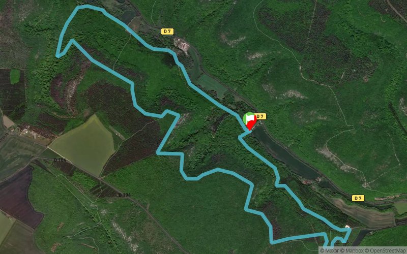


8.9 km
320 m
310 m
 Messigny-et-Vantoux (21)
 Points of Interest table
| Accum. | Intermediary | |||||||
|---|---|---|---|---|---|---|---|---|
| POI | Description | Alt. | Dist. | D+ | D- | Dist. | D+ | D- |
Trace n°24161
Ascent threshold : 3 m Distance threshold : 30 m Smoothing : Yes Origin of altitudes : MNT Aster GDEM
Ascent threshold : 3 m Distance threshold : 30 m Smoothing : Yes Origin of altitudes : MNT Aster GDEM
Loop
Dominant terrain : Footpath
Max alti. : 488 m
Avg alti. : 391 m
Min alti. : 312 m
Longest ascent : 190 m
Longest descent : 130 m
Route completed by the author : nc
Dominant terrain : Footpath
Max alti. : 488 m
Avg alti. : 391 m
Min alti. : 312 m
Longest ascent : 190 m
Longest descent : 130 m
Route completed by the author : nc
Elevation profile
More tools
Create a new roadbook page
Map and track on your website
Warning ! When you insert a Trace de Trail map on your website, you agree not to hide any element of the module (links to Trail Trail or Trail Connect banner)
Add a realisation
Validate
Add a realisation to share your chrono and describe the conditions that you encountered during you trail running !
Add a comment
Validate
dric73
25/07/16, 11:02:51
superbe paysage au dessus des falaises. par contre la montée est a 33% dure dure dans les cailloux
25/07/16, 11:02:51
superbe paysage au dessus des falaises. par contre la montée est a 33% dure dure dans les cailloux
Show the infos
Add a track


