Show the map
Angon - Chalet de l'Aulp - La Tournette - Vérel
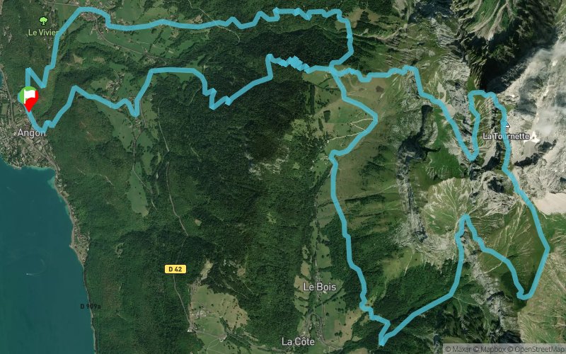


25.2 km
2230 m
2230 m
 Duingt (74)
 Points of Interest table
| Accum. | Intermediary | |||||||
|---|---|---|---|---|---|---|---|---|
| POI | Description | Alt. | Dist. | D+ | D- | Dist. | D+ | D- |
Trace n°23795
Ascent threshold : 3 m Distance threshold : 30 m Smoothing : Yes Origin of altitudes : MNT Aster GDEM
Ascent threshold : 3 m Distance threshold : 30 m Smoothing : Yes Origin of altitudes : MNT Aster GDEM
Loop
Dominant terrain : Footpath
Max alti. : 2294 m
Avg alti. : 1313 m
Min alti. : 463 m
Longest ascent : 1880 m
Longest descent : 1150 m
Route completed by the author : nc
Dominant terrain : Footpath
Max alti. : 2294 m
Avg alti. : 1313 m
Min alti. : 463 m
Longest ascent : 1880 m
Longest descent : 1150 m
Route completed by the author : nc
Elevation profile
More tools
Create a new roadbook page
Map and track on your website
Warning ! When you insert a Trace de Trail map on your website, you agree not to hide any element of the module (links to Trail Trail or Trail Connect banner)
Add a realisation
Validate
Add a realisation to share your chrono and describe the conditions that you encountered during you trail running !
Add a comment
Validate
Admin - Trace de Trail
15/07/17, 15:31:45
Bonjour, Les lieux de départ et d'arrivée sont calculés automatiquement, mais vous vous les changer en modification de trace.
15/07/17, 15:31:45
Bonjour, Les lieux de départ et d'arrivée sont calculés automatiquement, mais vous vous les changer en modification de trace.
gbonnat
15/07/17, 12:43:10
Attention il y a marqué départ Duingt (de l'autre côté du lac) au lieu de Angon.
15/07/17, 12:43:10
Attention il y a marqué départ Duingt (de l'autre côté du lac) au lieu de Angon.
Show the infos
Add a track


