Show the map
La Croix de Pinet - Combe de Vaux - Arthémonay - St-Ange
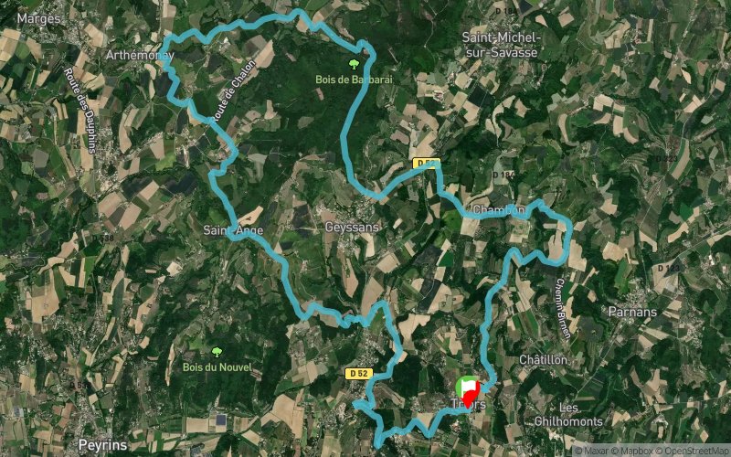


27.9 km
802 m
798 m
 Triors (26)
 Points of Interest table
| Accum. | Intermediary | |||||||
|---|---|---|---|---|---|---|---|---|
| POI | Description | Alt. | Dist. | D+ | D- | Dist. | D+ | D- |
Trace n°2206
Ascent threshold : 0 m Distance threshold : 35 m Smoothing : Yes Origin of altitudes : MNT Aster GDEM
Ascent threshold : 0 m Distance threshold : 35 m Smoothing : Yes Origin of altitudes : MNT Aster GDEM
Loop
Dominant terrain : Footpath
Max alti. : 471 m
Avg alti. : 325 m
Min alti. : 197 m
Longest ascent : 192 m
Longest descent : 133 m
Route completed by the author : nc
Dominant terrain : Footpath
Max alti. : 471 m
Avg alti. : 325 m
Min alti. : 197 m
Longest ascent : 192 m
Longest descent : 133 m
Route completed by the author : nc
Elevation profile
More tools
Create a new roadbook page
Map and track on your website
Warning ! When you insert a Trace de Trail map on your website, you agree not to hide any element of the module (links to Trail Trail or Trail Connect banner)
Add a realisation
Validate
Add a realisation to share your chrono and describe the conditions that you encountered during you trail running !
Add a comment
Validate
Lionfred26_
09/06/19, 22:12:58
Attention les chemins ne sont pas entretenus ni désherbés beaucoup de détour Je ne vous conseille pas à le faire
09/06/19, 22:12:58
Attention les chemins ne sont pas entretenus ni désherbés beaucoup de détour Je ne vous conseille pas à le faire
Show the infos
Add a track


