Show the map
Col de Voza - Col du Bresson - Col de la Leisse - Col de la Vallée Étroite - Col de Granon
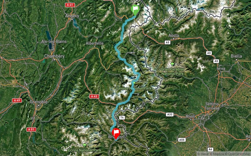


201.3 km
16980 m
16690 m
 Chamonix-Mont-Blanc (74)
 Briançon (05)
 Points of Interest table
| Accum. | Intermediary | |||||||
|---|---|---|---|---|---|---|---|---|
| POI | Description | Alt. | Dist. | D+ | D- | Dist. | D+ | D- |
Trace n°21840
Ascent threshold : 3 m Distance threshold : 0 m Smoothing : No Origin of altitudes : GPS
Ascent threshold : 3 m Distance threshold : 0 m Smoothing : No Origin of altitudes : GPS
Crossing
Dominant terrain : Footpath
Max alti. : 2741 m
Avg alti. : 1855 m
Min alti. : 724 m
Longest ascent : 2440 m
Longest descent : 2110 m
Route completed by the author : nc
Dominant terrain : Footpath
Max alti. : 2741 m
Avg alti. : 1855 m
Min alti. : 724 m
Longest ascent : 2440 m
Longest descent : 2110 m
Route completed by the author : nc
Elevation profile
More tools
Create a new roadbook page
Map and track on your website
Warning ! When you insert a Trace de Trail map on your website, you agree not to hide any element of the module (links to Trail Trail or Trail Connect banner)
Add a realisation
Validate
Add a realisation to share your chrono and describe the conditions that you encountered during you trail running !
Add a comment
Validate
Show the infos
Add a track


