Show the map
Evaluated Track - ITRA
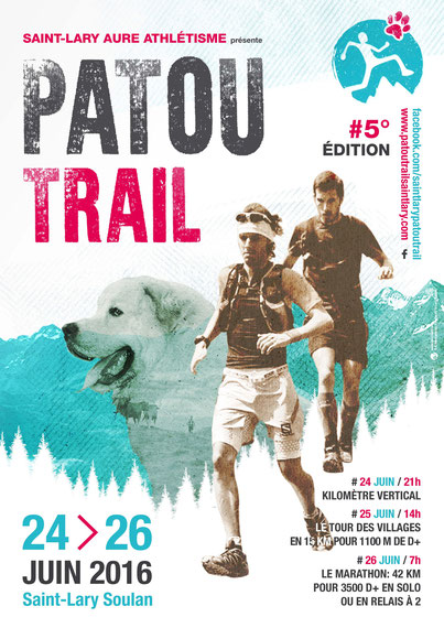
Saint-Lary Patou Trail 2016


 Saint-Lary-Soulan (65)


This mountain marathon solo or duo puts everyone agrees with its 42kms and its cumulative elevation gain of 3500m .
A magnificent course, a varied and technical field: all the ingredients that make a great and beautiful trail running .
From the place of the Tourist Office of St Lary , it rises to Soulan through the Granges Grascoueou before joining Tramezaygues then begin the long ascent to the beautiful and coveted Lake Consaterre . A view that deserves before returning to Saint-Lary-Soulan after a frantic descent , and enjoy the arrival in the heart of the village.
Points of Interest table
| Accum. | Intermediary | |||||||
|---|---|---|---|---|---|---|---|---|
| POI | Description | Alt. | Dist. | D+ | D- | Dist. | D+ | D- |
 Competition organized on 06/26/2016
Trace n°20570
Ascent threshold : 3 m Distance threshold : 30 m Smoothing : Yes Origin of altitudes : MNT IGN
Ascent threshold : 3 m Distance threshold : 30 m Smoothing : Yes Origin of altitudes : MNT IGN
Loop
Dominant terrain : Footpath
Max alti. : 2348 m
Avg alti. : 1359 m
Min alti. : 782 m
Longest ascent : 1240 m
Longest descent : 1370 m
Dominant terrain : Footpath
Max alti. : 2348 m
Avg alti. : 1359 m
Min alti. : 782 m
Longest ascent : 1240 m
Longest descent : 1370 m
Elevation profile
More tools
Create a new roadbook page
Map and track on your website
Warning ! When you insert a Trace de Trail map on your website, you agree not to hide any element of the module (links to Trail Trail or Trail Connect banner)
Add a realisation
Validate
Add a realisation to share your chrono and describe the conditions that you encountered during you trail running !
Add a comment
Validate
Show the infos
Add a track


