Show the map
Le Coudray-Montceaux - Mondeville - Bois de Turelle
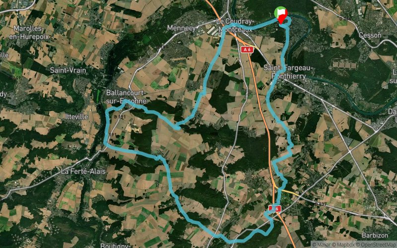


54.8 km
530 m
530 m
 Saint-Fargeau-Ponthierry (77)
 Points of Interest table
| Accum. | Intermediary | |||||||
|---|---|---|---|---|---|---|---|---|
| POI | Description | Alt. | Dist. | D+ | D- | Dist. | D+ | D- |
Trace n°19090
Ascent threshold : 3 m Distance threshold : 30 m Smoothing : Yes Origin of altitudes : MNT Aster GDEM
Ascent threshold : 3 m Distance threshold : 30 m Smoothing : Yes Origin of altitudes : MNT Aster GDEM
Loop
Dominant terrain : Path
Max alti. : 144 m
Avg alti. : 73 m
Min alti. : 29 m
Longest ascent : 110 m
Longest descent : 100 m
Route completed by the author : nc
Dominant terrain : Path
Max alti. : 144 m
Avg alti. : 73 m
Min alti. : 29 m
Longest ascent : 110 m
Longest descent : 100 m
Route completed by the author : nc
Elevation profile
More tools
Create a new roadbook page
Map and track on your website
Warning ! When you insert a Trace de Trail map on your website, you agree not to hide any element of the module (links to Trail Trail or Trail Connect banner)
Add a realisation
Validate
Add a realisation to share your chrono and describe the conditions that you encountered during you trail running !
Add a comment
Validate
jlou
14/09/20, 23:58:32
Nombreux chemins non praticables pour causes d'érosion, de grille fermée, ou propriété privée. 60 km au lieu de 54. Sortie intéressante malgré ces désagréments.
14/09/20, 23:58:32
Nombreux chemins non praticables pour causes d'érosion, de grille fermée, ou propriété privée. 60 km au lieu de 54. Sortie intéressante malgré ces désagréments.
Show the infos
Add a track


