Show the map
Col de Bazech - Col d'Ussat - Clot de la Carbonnière - Col de Martel
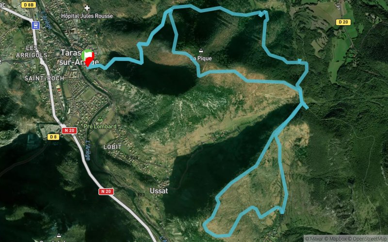


15.3 km
1050 m
1030 m
 Tarascon-sur-Ariège (09)
 Points of Interest table
| Accum. | Intermediary | |||||||
|---|---|---|---|---|---|---|---|---|
| POI | Description | Alt. | Dist. | D+ | D- | Dist. | D+ | D- |
Trace n°17459
Ascent threshold : 3 m Distance threshold : 30 m Smoothing : Yes Origin of altitudes : MNT Aster GDEM
Ascent threshold : 3 m Distance threshold : 30 m Smoothing : Yes Origin of altitudes : MNT Aster GDEM
Loop
Dominant terrain : Footpath
Max alti. : 998 m
Avg alti. : 769 m
Min alti. : 479 m
Longest ascent : 330 m
Longest descent : 520 m
Route completed by the author : nc
Dominant terrain : Footpath
Max alti. : 998 m
Avg alti. : 769 m
Min alti. : 479 m
Longest ascent : 330 m
Longest descent : 520 m
Route completed by the author : nc
Elevation profile
More tools
Create a new roadbook page
Map and track on your website
Warning ! When you insert a Trace de Trail map on your website, you agree not to hide any element of the module (links to Trail Trail or Trail Connect banner)
Add a realisation
Validate
Add a realisation to share your chrono and describe the conditions that you encountered during you trail running !
Add a comment
Validate
illoua
31/01/16, 19:36:25
Parcours inspiré de 2 rands proposées dans le "topo-guide des montagnes de Tarascan et du Vicdessos" en vente à l'office de Tourisme. Variantes possibles pour raccourcir ou allonger. Tarascon est bien desservi par le train!
31/01/16, 19:36:25
Parcours inspiré de 2 rands proposées dans le "topo-guide des montagnes de Tarascan et du Vicdessos" en vente à l'office de Tourisme. Variantes possibles pour raccourcir ou allonger. Tarascon est bien desservi par le train!
Show the infos
Add a track


