Show the map
Mont Chanzet - Veyssilieu
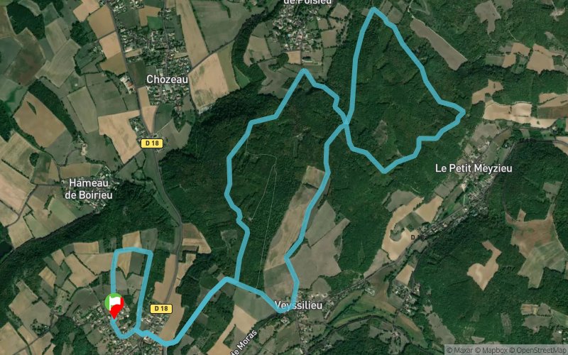


10.8 km
320 m
330 m
 Panossas (38)
 Points of Interest table
| Accum. | Intermediary | |||||||
|---|---|---|---|---|---|---|---|---|
| POI | Description | Alt. | Dist. | D+ | D- | Dist. | D+ | D- |
Trace n°16560
Ascent threshold : 1 m Distance threshold : 30 m Smoothing : Yes Origin of altitudes : MNT Aster GDEM
Ascent threshold : 1 m Distance threshold : 30 m Smoothing : Yes Origin of altitudes : MNT Aster GDEM
Loop
Dominant terrain : Path
Max alti. : 393 m
Avg alti. : 324 m
Min alti. : 269 m
Longest ascent : 90 m
Longest descent : 90 m
Route completed by the author : nc
Dominant terrain : Path
Max alti. : 393 m
Avg alti. : 324 m
Min alti. : 269 m
Longest ascent : 90 m
Longest descent : 90 m
Route completed by the author : nc
Elevation profile
More tools
Create a new roadbook page
Map and track on your website
Warning ! When you insert a Trace de Trail map on your website, you agree not to hide any element of the module (links to Trail Trail or Trail Connect banner)
Add a realisation
Validate
Add a comment
Validate
Nykolas
13/08/19, 22:58:36
Parcourt réalisé le 13 août 2019. Parcourt très boisé idéal par forte chaleur et très agréable à courir.
13/08/19, 22:58:36
Parcourt réalisé le 13 août 2019. Parcourt très boisé idéal par forte chaleur et très agréable à courir.
Show the infos
Add a track


