Show the map
Evaluated Track - ITRA
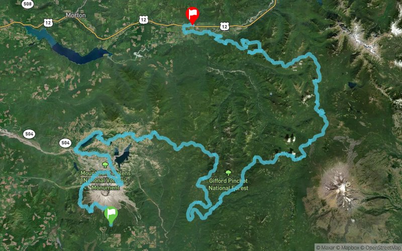
Bigfoot Endurance Runs 2015 - Bigfoot 200


 Cougar (US)
 Randle (US)


The Bigfoot 200 is a point to point traverse of some of the most stunning, wild, and scenic trails in the Cascade Mountain range of Washington State. The race ends in Randle, WA after crossing the Cascade Mountains from Mount St. Helens to Mt. Adams and along ridge lines with views of volcanoes Mt. Rainier, Mt. Hood, Mt Adams and more!
Points of Interest table
| Accum. | Intermediary | |||||||
|---|---|---|---|---|---|---|---|---|
| POI | Description | Alt. | Dist. | D+ | D- | Dist. | D+ | D- |
 Competition organized on 08/07/2015
Trace n°15550
Ascent threshold : 3 m Distance threshold : 30 m Smoothing : Yes Origin of altitudes : MNT Aster GDEM
Ascent threshold : 3 m Distance threshold : 30 m Smoothing : Yes Origin of altitudes : MNT Aster GDEM
Crossing
Dominant terrain : Footpath
Max alti. : 1741 m
Avg alti. : 1159 m
Min alti. : 253 m
Longest ascent : 1310 m
Longest descent : 1740 m
Dominant terrain : Footpath
Max alti. : 1741 m
Avg alti. : 1159 m
Min alti. : 253 m
Longest ascent : 1310 m
Longest descent : 1740 m
Elevation profile
More tools
Create a new roadbook page
Map and track on your website
Warning ! When you insert a Trace de Trail map on your website, you agree not to hide any element of the module (links to Trail Trail or Trail Connect banner)
Add a realisation
Validate
Add a realisation to share your chrono and describe the conditions that you encountered during you trail running !
Add a comment
Validate
Show the infos
Add a track


