Show the map
Tour du Chandelier
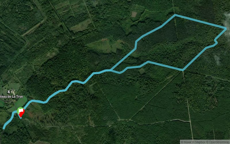


8.9 km
190 m
193 m
 Hermes (60)
 Points of Interest table
| Accum. | Intermediary | |||||||
|---|---|---|---|---|---|---|---|---|
| POI | Description | Alt. | Dist. | D+ | D- | Dist. | D+ | D- |
Trace n°1417
Ascent threshold : 0 m Distance threshold : 35 m Smoothing : Yes Origin of altitudes : MNT Aster GDEM
Ascent threshold : 0 m Distance threshold : 35 m Smoothing : Yes Origin of altitudes : MNT Aster GDEM
Loop
Dominant terrain : Footpath
Max alti. : 153 m
Avg alti. : 89 m
Min alti. : 56 m
Longest ascent : 75 m
Longest descent : 117 m
Route completed by the author : nc
Dominant terrain : Footpath
Max alti. : 153 m
Avg alti. : 89 m
Min alti. : 56 m
Longest ascent : 75 m
Longest descent : 117 m
Route completed by the author : nc
Elevation profile
More tools
Create a new roadbook page
Map and track on your website
Warning ! When you insert a Trace de Trail map on your website, you agree not to hide any element of the module (links to Trail Trail or Trail Connect banner)
Add a realisation
Validate
Add a realisation to share your chrono and describe the conditions that you encountered during you trail running !
Add a comment
Validate
Admin - Trace de Trail
11/11/13, 19:15:25
Alors là ça fait pas rire : la trace du cerf-volant !
Bravissimo
Bon maintenant, il faut ajouter une photo et des points d'intérêt !
11/11/13, 19:15:25
Alors là ça fait pas rire : la trace du cerf-volant !
Bravissimo
Bon maintenant, il faut ajouter une photo et des points d'intérêt !
Show the infos
Add a track


