
The Canyons Endurance Runs 2016 - 100Km
ITRA
 103.5 km
5730 m
5750 m
103.5 km
5730 m
5750 m


GPX
7
PDF
Profile
Share
3D
Favorites
Reviews
Like
Foresthill (US) Foresthill (US)
Effort kilometer
Longest ascent
Longest descent
160
840 m
950 m
Max. elevation
Min. elevation
Quality index
1335 m
224 m
 1pt/13m
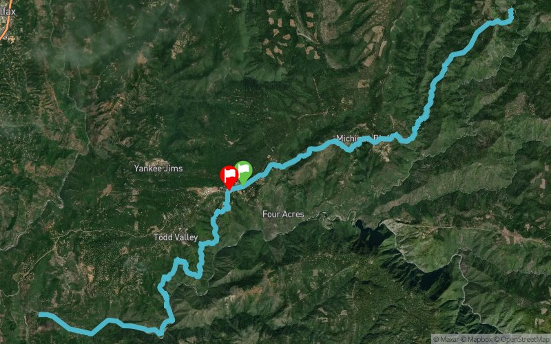
The canyons is on the fabled Western States course. It goes through the teeth of the course and goes through all the major canyons. This is 2 out and backs

Start
Distance
0 km
Altitude
1001 m
D+
0 m
D-
0 m
103.5 km
5721 m
5750 m
Finish
Distance
103.5 km
Altitude
981 m
D+
5721 m
D-
5750 m
Click on a point of interest to display it on the map
Reviews and times
Add a track
The Canyons Endurance Runs 2016 - 100Km

Track number : 13779
Link to track :
https://tracedetrail.fr/en/trace/13779
Log in to insert this track on your website
 Trace de Trail