Show the map
TMB 2020
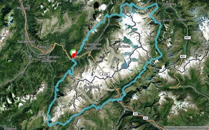


164.8 km
13720 m
13720 m
 Les Houches (74)
 Points of Interest table
| Accum. | Intermediary | |||||||
|---|---|---|---|---|---|---|---|---|
| POI | Description | Alt. | Dist. | D+ | D- | Dist. | D+ | D- |
 Event off organized on 08/03/2020
Trace n°113460
Ascent threshold : 3 m Distance threshold : 30 m Smoothing : Yes Origin of altitudes : MNT Aster GDEM
Ascent threshold : 3 m Distance threshold : 30 m Smoothing : Yes Origin of altitudes : MNT Aster GDEM
Loop
Dominant terrain : Footpath
Max alti. : 2690 m
Avg alti. : 1926 m
Min alti. : 981 m
Longest ascent : 1380 m
Longest descent : 1520 m
Dominant terrain : Footpath
Max alti. : 2690 m
Avg alti. : 1926 m
Min alti. : 981 m
Longest ascent : 1380 m
Longest descent : 1520 m
Elevation profile
More tools
Create a new roadbook page
Map and track on your website
Warning ! When you insert a Trace de Trail map on your website, you agree not to hide any element of the module (links to Trail Trail or Trail Connect banner)
Add a realisation
Validate
Add a realisation to share your chrono and describe the conditions that you encountered during you trail running !
Add a comment
Validate
Admin - Trace de Trail
17/06/20, 23:38:16
Bonjour, Merci de respecter les règles de nommage du site avant de placer votre trace en public.
17/06/20, 23:38:16
Bonjour, Merci de respecter les règles de nommage du site avant de placer votre trace en public.
Show the infos
Add a track


