Hike around Mont Aiguille
Add to my favorites

Caution! Zone of vigilance near the route
Aigle royal - du 01/01/2024 au 31/08/2024 In progress

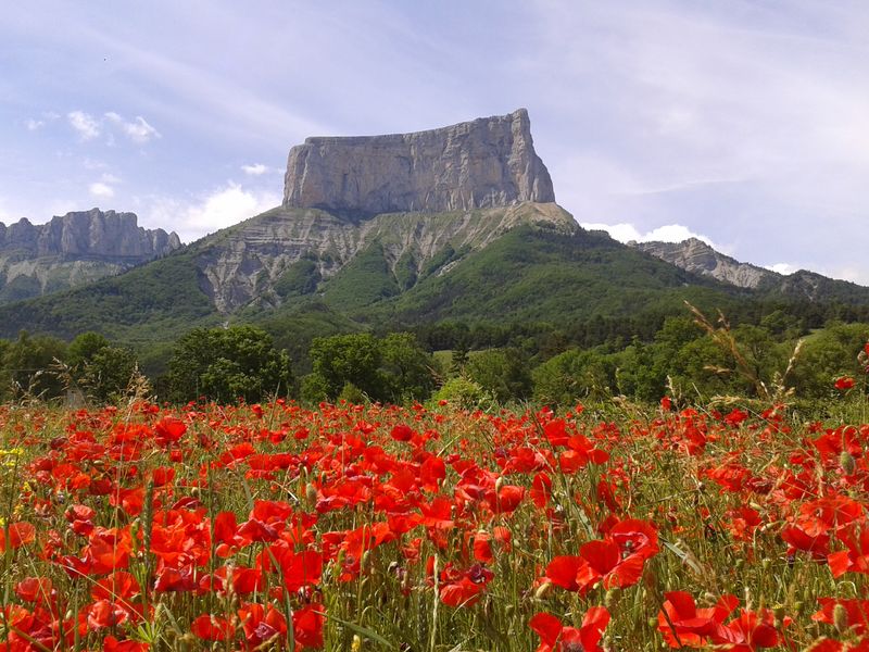
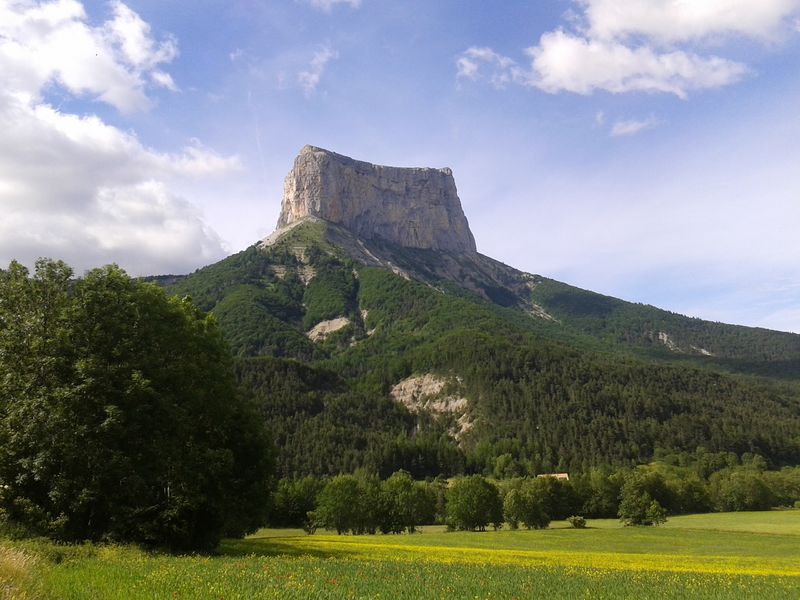
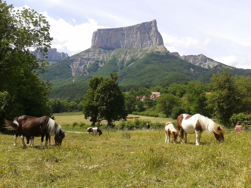
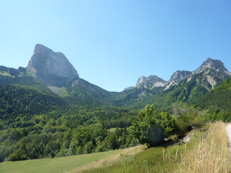
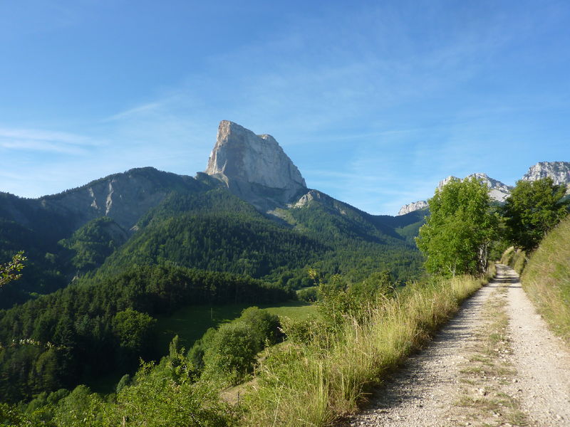
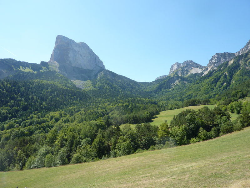
This superb, long hike allows capable ramblers to view the limestone needle, separated from its original neighbouring cliff, from all angles. You will encounter an astonishing variety of landscapes.
Route labeled FFRandonnée

The characteristics of the route.

Chichilianne (38)
- Distance 18.3 km
- Elevation gain 1160 m
- Elevation lost 1160 m
- Min. elevation 1004 m
- Max. elevation. 1704 m
- Duration (depending on pace) 7h
- Marking Yes
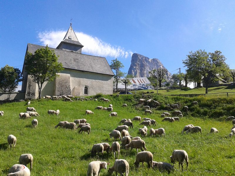
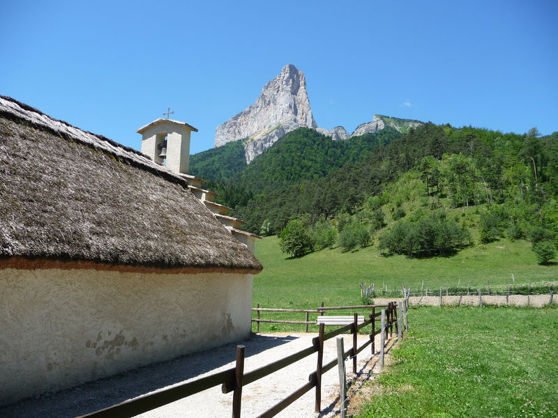
From the car park, retrace your steps for 300m and take the path to the left, which leads to the edge of the forest, and then continues uphill alongside it. Then walk alongside cultivated fields to join another path, and turn left. The track rises at first before descending to join up with the road to Trézanne. After the Romanesque chapel, walk up to the Col de Papavet. From the pass, continue to the left along a wooded ridge until you reach the Col des Pellas. Descend into the hamlet of Les Pellas (typical houses of the Trièves region). Follow the road to the left for 500m, then, on the bend, continue straight ahead, towards the Col de l'Aupet. You will pass paths off to the right which lead to Pas des Bachasson and Pas de la Selle. A forest track, which starts off steep, will take you to a point above the La Pisse waterfalls. The many fallen trees beneath Mont Aiguille are testament to the harshness of this steep slope. The track continues on a gentle downhill slope to reach the Col de l'Aupet. Take the path on the steep, south-west side of Mont Aiguille to descend. The path emerges among the meadows of the Côtes de la Doux before reaching the bottom of the valley. Turn left to head back to the car park.Marking : Yellow-and-green (Vercors Natural Park)Equipments : Car park, Delicate passages : This long hike requires a good level of physical fitness. In spring, enquire about the presence of névé in the steep, craggy sections.Admission fee : Free access.Opening : From 01/05 to 01/09.
Subject to favorable weather.
Area : Trièves
Report a problem Add a comment
Website Roadbook Le tour du Mont Aiguille Pdf file Features of the application :
- Location and orientation on detailed maps thanks to the GPS of your smartphone
- Description of routes and points of interest on the route
- Photo gallery by route
- Detailed elevation profile
- Route tracking alert to warn you if you stray from the route
- Send predefined messages by SMS to your contacts
- Emergency module: trigger a call or send an emergency SMS in case of problem
- Agenda: access to events organized in the department
- News: find in the application the latest news on the web portal
- Adding achievements
- Add reports in case of problems encountered on the routes
- Share on social networks
Add your time and share your feelings
Services nearby

Foyer nordique de Chichilianne
Chichilianne

Point d'information Chichilianne
Chichilianne
Foyer nordique de Gresse-en-Vercors
Gresse-en-Vercors
Bureau d'Informations Touristiques de Gresse en Vercors - Office de Tourisme du Trièves
Gresse-en-Vercors

Espace Giono
Lalley


Information updated on 2022-10-06 by Isère Attractivité


Follow us on
the digital trails
the digital trails


![]()
The Isère Outdoor application was created
by the Département de l'Isère
Infos & contact
Conseil départemental de l'Isère
7 rue Fantin Latour
CS 41096
38 022 Grenoble cedex 1
Tel. 04 76 00 38 38


OK
Annuler