The tour through the plateau of Matheysin
Add to my favorites

Caution! Zone of vigilance near the route
Tétras lyre - hiver - du 01/01/2024 au 30/04/2024 In progress
Tétras lyre - hiver - du 01/01/2024 au 30/04/2024 In progress
Tétras lyre - hiver - du 01/01/2024 au 30/04/2024 In progress
Tétras lyre - hiver - du 01/01/2024 au 30/04/2024 In progress
Tétras lyre - hiver - du 01/01/2024 au 30/04/2024 In progress
Faucon pèlerin - du 01/02/2024 au 30/06/2024 In progress
Faucon pèlerin - du 01/02/2024 au 30/06/2024 In progress
Faucon pèlerin - du 01/02/2024 au 30/06/2024 In progress
Circaète Jean-le-Blanc - du 01/03/2024 au 30/09/2024 In progress
Circaète Jean-le-Blanc - du 01/03/2024 au 30/09/2024 In progress
Circaète Jean-le-Blanc - du 01/03/2024 au 30/09/2024 In progress
Circaète Jean-le-Blanc - du 01/03/2024 au 30/09/2024 In progress
Circaète Jean-le-Blanc - du 01/03/2024 au 30/09/2024 In progress
Circaète Jean-le-Blanc - du 01/03/2024 au 30/09/2024 In progress
Aigle royal - du 01/01/2024 au 31/08/2024 In progress
Aigle royal - du 01/01/2024 au 31/08/2024 In progress
Aigle royal - du 01/01/2024 au 31/08/2024 In progress
Aigle royal - du 01/01/2024 au 31/08/2024 In progress

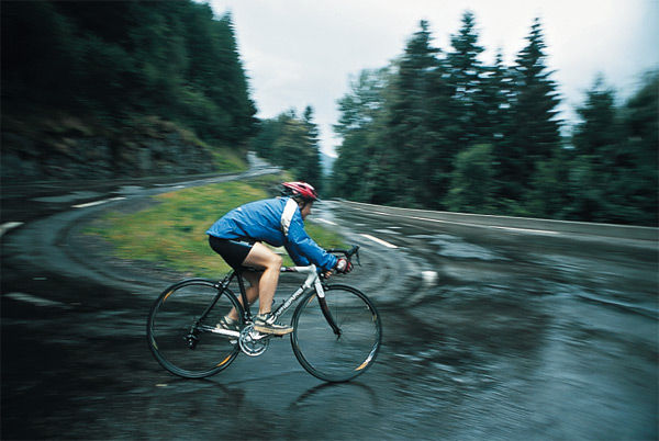
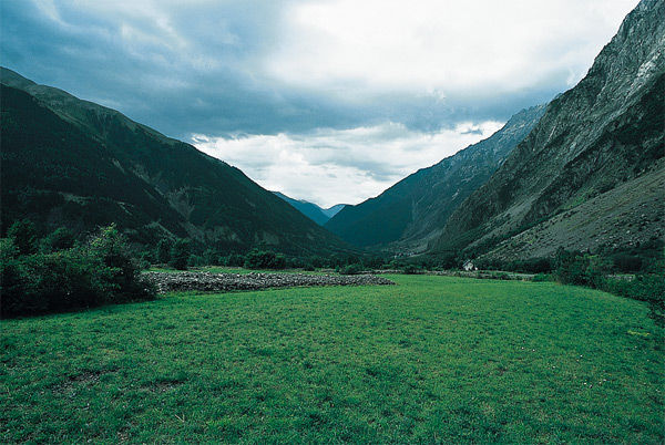
This big loop is popular among local cyclists. You leave Oisans by Col d'Ornon to drop down to Valbonnais, then to the plateau of Matheysin. You will climb up to La Morte by a pretty route with little traffic.
The characteristics of the route.

Le Bourg-d'Oisans (38)
- Distance 99.1 km
- Elevation gain 2010 m
- Elevation lost 2010 m
- Min. elevation 365 m
- Max. elevation. 1371 m
- Duration (depending on pace) 5h30
- Marking No
Itinerary no. 11 of the “Cycling in Oisans” guide (Oisans Tourisme)
Departure / Arrival (loop): Bourg d’Oisans 720 m
Time: 5 h 30
Distance: 100 km
Highest point: 1380 m
Lowest point: 360 m
Total ascent: 2010 m
Max. gradient: 10%
Map: Michelin Local Map no. 333 Isère, Savoie
ITINERARY
From Bourg d’Oisans, follow the D1091 towards Grenoble.
After the second kilometre turn left and follow the D526 towards Valbonnais - La Mure - Ornon. From the pass, go down to Valbonnais.
From Valbonnais, turn right and follow the D26 towards La Mure.
In Sievoz, turn right and cycle on the D114a towards La Morte (ski resort of Alpe du Grand Serre).
Then go to Séchilienne (be careful on the downhill slope) and turn right on the D1091 to come back to Bourg d’Oisans.
ALTERNATIVE ROUTE Via Laffrey
From Siévoz, ride to La Mure on the D26.
After La Mure, take the D115c. Cross through St Honoré, Fugières, Villard Saint Christophe and Cholonge before to go down to Laffrey.
After Laffrey, turn right on the D113 towards Saint Barthélémy de Séchilienne. Then go to Séchilienne (be careful on the downhill slope) and turn right on the D1091 to come back to Bourg d’Oisans.
---
Distance: 97 km
Time: 5 h
Total ascent: 1836 mOpening : From 05/01 to 10/31 : open daily.
Area : Oisans
Report a problem Add a comment
Website Features of the application :
- Location and orientation on detailed maps thanks to the GPS of your smartphone
- Description of routes and points of interest on the route
- Photo gallery by route
- Detailed elevation profile
- Route tracking alert to warn you if you stray from the route
- Send predefined messages by SMS to your contacts
- Emergency module: trigger a call or send an emergency SMS in case of problem
- Agenda: access to events organized in the department
- News: find in the application the latest news on the web portal
- Adding achievements
- Add reports in case of problems encountered on the routes
- Share on social networks
Add your time and share your feelings
Services nearby

Tourist office of Le Bourg-d'Oisans
Le Bourg-d'Oisans

Museum of Minerals and Alpine Wildlife
Le Bourg-d'Oisans
Auris-en-Oisans tourist office
Auris-en-Oisans
Tourist office of Villard-Reculas
Villard-Reculas
Office de Tourisme
Alpe d'Huez


Follow us on
the digital trails
the digital trails


![]()
The Isère Outdoor application was created
by the Département de l'Isère
Infos & contact
Conseil départemental de l'Isère
7 rue Fantin Latour
CS 41096
38 022 Grenoble cedex 1
Tel. 04 76 00 38 38


OK
Annuler