Show the map
Chap. St-Criat - Bois de Malessard - Bois de Verzé
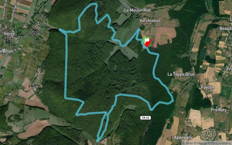


12.3 km
440 m
440 m
 Verzé (71)
 Points of Interest table
| Accum. | Intermediary | |||||||
|---|---|---|---|---|---|---|---|---|
| POI | Description | Alt. | Dist. | D+ | D- | Dist. | D+ | D- |
Trace n°110531
Ascent threshold : 2 m Distance threshold : 30 m Smoothing : Yes Origin of altitudes : MNT Aster GDEM
Ascent threshold : 2 m Distance threshold : 30 m Smoothing : Yes Origin of altitudes : MNT Aster GDEM
Loop
Dominant terrain : Footpath
Max alti. : 397 m
Avg alti. : 330 m
Min alti. : 261 m
Longest ascent : 100 m
Longest descent : 80 m
Route completed by the author : No
Dominant terrain : Footpath
Max alti. : 397 m
Avg alti. : 330 m
Min alti. : 261 m
Longest ascent : 100 m
Longest descent : 80 m
Route completed by the author : No
Elevation profile
More tools
Create a new roadbook page
Map and track on your website
Warning ! When you insert a Trace de Trail map on your website, you agree not to hide any element of the module (links to Trail Trail or Trail Connect banner)
Add a realisation
Validate
Add a realisation to share your chrono and describe the conditions that you encountered during you trail running !
Add a comment
Validate
Stephaneenroute
14/11/21, 16:24:01
Merci pour cette sortie. Sortie très sympa avec 2 biches rencontrées malgré les nombreux chasseurs. Certains chemins après le km 2 et km 10 semblent avoir disparus sous la végétation.
14/11/21, 16:24:01
Merci pour cette sortie. Sortie très sympa avec 2 biches rencontrées malgré les nombreux chasseurs. Certains chemins après le km 2 et km 10 semblent avoir disparus sous la végétation.
Show the infos
Add a track


