Show the map
Les Trois Becs - Forêt de Saou
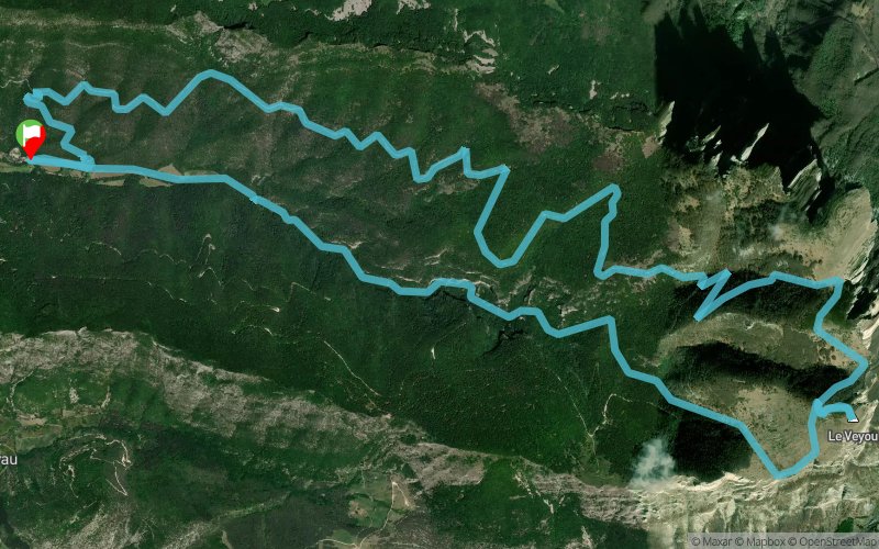


20.6 km
1441 m
1430 m
 Saint-Sauveur-en-Diois (26)
 Points of Interest table
| Accum. | Intermediary | |||||||
|---|---|---|---|---|---|---|---|---|
| POI | Description | Alt. | Dist. | D+ | D- | Dist. | D+ | D- |
Trace n°10834
Ascent threshold : 2 m Distance threshold : 30 m Smoothing : Yes Origin of altitudes : MNT Aster GDEM
Ascent threshold : 2 m Distance threshold : 30 m Smoothing : Yes Origin of altitudes : MNT Aster GDEM
Loop
Dominant terrain : Footpath
Max alti. : 1518 m
Avg alti. : 979 m
Min alti. : 469 m
Longest ascent : 1051 m
Longest descent : 845 m
Route completed by the author : nc
Dominant terrain : Footpath
Max alti. : 1518 m
Avg alti. : 979 m
Min alti. : 469 m
Longest ascent : 1051 m
Longest descent : 845 m
Route completed by the author : nc
Elevation profile
More tools
Create a new roadbook page
Map and track on your website
Warning ! When you insert a Trace de Trail map on your website, you agree not to hide any element of the module (links to Trail Trail or Trail Connect banner)
Add a realisation
Validate
Add a realisation to share your chrono and describe the conditions that you encountered during you trail running !
Add a comment
Validate
Admin - Trace de Trail
29/08/15, 09:08:05
Super le panoramique, ça donne envie d'aller y faire un tour ! Merci pour le partage
29/08/15, 09:08:05
Super le panoramique, ça donne envie d'aller y faire un tour ! Merci pour le partage
More comments
Show the infos
Add a track


