Show the map
Port Miou - Col de l'Oule - Falaises du Devenson
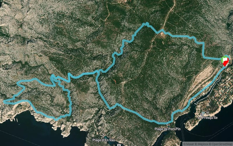


12.7 km
690 m
690 m
 Cassis (13)
 Points of Interest table
| Accum. | Intermediary | |||||||
|---|---|---|---|---|---|---|---|---|
| POI | Description | Alt. | Dist. | D+ | D- | Dist. | D+ | D- |
Trace n°107937
Ascent threshold : 3 m Distance threshold : 30 m Smoothing : Yes Origin of altitudes : MNT Aster GDEM
Ascent threshold : 3 m Distance threshold : 30 m Smoothing : Yes Origin of altitudes : MNT Aster GDEM
Loop
Dominant terrain : Footpath
Max alti. : 240 m
Avg alti. : 119 m
Min alti. : 0 m
Longest ascent : 200 m
Longest descent : 170 m
Route completed by the author : No
Dominant terrain : Footpath
Max alti. : 240 m
Avg alti. : 119 m
Min alti. : 0 m
Longest ascent : 200 m
Longest descent : 170 m
Route completed by the author : No
Elevation profile
More tools
Create a new roadbook page
Map and track on your website
Warning ! When you insert a Trace de Trail map on your website, you agree not to hide any element of the module (links to Trail Trail or Trail Connect banner)
Add a realisation
Validate
Add a realisation to share your chrono and describe the conditions that you encountered during you trail running !
Add a comment
Validate
Benatoulouse
15/03/21, 20:51:43
Ballade magnifique / 21 km depuis Cassis avec passage par la pointe d'en Vau + un stop à la calanque d'en Vau
15/03/21, 20:51:43
Ballade magnifique / 21 km depuis Cassis avec passage par la pointe d'en Vau + un stop à la calanque d'en Vau
Show the infos
Add a track


