Show the map
Le Boulard - St-Genoux - Le Signal - St-André-la-Côte
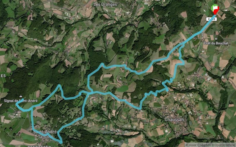


16.4 km
620 m
620 m
 Rontalon (69)
 Points of Interest table
| Accum. | Intermediary | |||||||
|---|---|---|---|---|---|---|---|---|
| POI | Description | Alt. | Dist. | D+ | D- | Dist. | D+ | D- |
Trace n°106118
Ascent threshold : 3 m Distance threshold : 30 m Smoothing : No Origin of altitudes : MNT Aster GDEM
Ascent threshold : 3 m Distance threshold : 30 m Smoothing : No Origin of altitudes : MNT Aster GDEM
Loop
Dominant terrain : Footpath
Max alti. : 921 m
Avg alti. : 665 m
Min alti. : 501 m
Longest ascent : 360 m
Longest descent : 360 m
Route completed by the author : Yes
Dominant terrain : Footpath
Max alti. : 921 m
Avg alti. : 665 m
Min alti. : 501 m
Longest ascent : 360 m
Longest descent : 360 m
Route completed by the author : Yes
Elevation profile
More tools
Create a new roadbook page
Map and track on your website
Warning ! When you insert a Trace de Trail map on your website, you agree not to hide any element of the module (links to Trail Trail or Trail Connect banner)
Add a realisation
Validate
Add a realisation to share your chrono and describe the conditions that you encountered during you trail running !
Add a comment
Validate
21403NYC2017
18/12/20, 15:33:09
Merci j'en suis ravie!! Au mois cette fois-ci vous ne vous êtes pas retrouvé les pieds dans l'eau. Au départ de l'aéromodélisme il y a plusieurs parcours fantastiques pour monter au Signal. Je vais en mettre un autre sur trace de trail.
18/12/20, 15:33:09
Merci j'en suis ravie!! Au mois cette fois-ci vous ne vous êtes pas retrouvé les pieds dans l'eau. Au départ de l'aéromodélisme il y a plusieurs parcours fantastiques pour monter au Signal. Je vais en mettre un autre sur trace de trail.
Gatien Roussel
18/12/20, 13:31:58
Super tracé ! Avec vue panoramique en bonus - quand il n’y a pas de brouillard... merci beaucoup !!
18/12/20, 13:31:58
Super tracé ! Avec vue panoramique en bonus - quand il n’y a pas de brouillard... merci beaucoup !!
Show the infos
Add a track


