N°60 : Les eaux douces
Add to my favorites

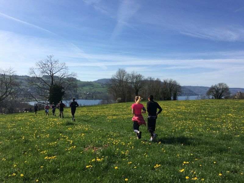
Un parcours pour les coureurs entraînés profitant de jolis panoramas sur le lac de Paladru. De Charavines à la Sylve Bénite et la Grange Dîmière, puis vers les étangs du Thivoley et Montfollet pour finir avec la Croix des cochettes.
The characteristics of the route.
Charavines (38)
- Distance 25.7 km
- Elevation gain 740 m
- Elevation lost 740 m
- Min. elevation 485 m
- Max. elevation. 768 m
- Marking Yes
Admission fee : Free access.Opening : All year round.
Area : Pays Voironnais
Report a problem Add a comment
Website Parcours trail n° 60 : Les eaux douces - Roadbook Pdf file Features of the application :
- Location and orientation on detailed maps thanks to the GPS of your smartphone
- Description of routes and points of interest on the route
- Photo gallery by route
- Detailed elevation profile
- Route tracking alert to warn you if you stray from the route
- Send predefined messages by SMS to your contacts
- Emergency module: trigger a call or send an emergency SMS in case of problem
- Agenda: access to events organized in the department
- News: find in the application the latest news on the web portal
- Adding achievements
- Add reports in case of problems encountered on the routes
- Share on social networks
Add your time and share your feelings
Services nearby

Pays Voironnais Tourist Office, Lake Paladru information office
Charavines

Lake Paladru Archeological Museum
Villages du lac de Paladru

Espace Naturel Sensible des Marais de la Véronnière et du Courbon
Villages du lac de Paladru
Clog museum
Val-de-Virieu
Tourisme en Bièvre Est
Colombe


Information updated on 2023-07-18 by Office de Tourisme du Pays Voironnais


Follow us on
the digital trails
the digital trails


![]()
The Isère Outdoor application was created
by the Département de l'Isère
Infos & contact
Conseil départemental de l'Isère
7 rue Fantin Latour
CS 41096
38 022 Grenoble cedex 1
Tel. 04 76 00 38 38


OK
Annuler