Show the map
Ferme de Baïn - Col de la Raille
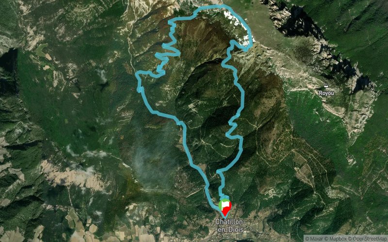


13.8 km
1218 m
1217 m
 Châtillon-en-Diois (26)
 Points of Interest table
| Accum. | Intermediary | |||||||
|---|---|---|---|---|---|---|---|---|
| POI | Description | Alt. | Dist. | D+ | D- | Dist. | D+ | D- |
Trace n°10499
Ascent threshold : 2 m Distance threshold : 30 m Smoothing : Yes Origin of altitudes : MNT Aster GDEM
Ascent threshold : 2 m Distance threshold : 30 m Smoothing : Yes Origin of altitudes : MNT Aster GDEM
Loop
Dominant terrain : Footpath
Max alti. : 1764 m
Avg alti. : 1102 m
Min alti. : 595 m
Longest ascent : 1214 m
Longest descent : 1178 m
Route completed by the author : nc
Dominant terrain : Footpath
Max alti. : 1764 m
Avg alti. : 1102 m
Min alti. : 595 m
Longest ascent : 1214 m
Longest descent : 1178 m
Route completed by the author : nc
Elevation profile
More tools
Create a new roadbook page
Map and track on your website
Warning ! When you insert a Trace de Trail map on your website, you agree not to hide any element of the module (links to Trail Trail or Trail Connect banner)
Add a realisation
Validate
Add a realisation to share your chrono and describe the conditions that you encountered during you trail running !
Add a comment
Validate
perecastor
17/08/15, 11:48:55
Utilise à la montée un sentier non répertorié après la ferme de Baïn. Avant la ferme, descendez et traversez le ruisseau et remontez sur 200m pour trouver le sentier.
17/08/15, 11:48:55
Utilise à la montée un sentier non répertorié après la ferme de Baïn. Avant la ferme, descendez et traversez le ruisseau et remontez sur 200m pour trouver le sentier.
Show the infos
Add a track


