Show the map
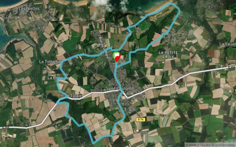
Anse du Guesclin - Étang de Ste-Suzanne


11.3 km
250 m
250 m

Points of Interest table
Accum. | Intermediary | |||||||
---|---|---|---|---|---|---|---|---|
POI | Description | Alt. | Dist. | D+ | D- | Dist. | D+ | D- |
Trace n°101123
Ascent threshold : 3 m Distance threshold : 30 m Smoothing : Yes Origin of altitudes : MNT Aster GDEM
Loop
Dominant terrain : Path
Max alti. : 66 m
Avg alti. : 35 m
Min alti. : 8 m
Longest ascent : 60 m
Longest descent : 60 m
Route completed by the author : Yes
Dominant terrain : Path
Max alti. : 66 m
Avg alti. : 35 m
Min alti. : 8 m
Longest ascent : 60 m
Longest descent : 60 m
Route completed by the author : Yes
Elevation profile

Their last tracks
La Houle - Pointe des Roches Noires - Terrelabouët - La Ville Garnier
8.9 km
270 m
280 m
Cancale (35)
More tools
Create a new roadbook page
Carte à la Carte IGN
Map and track on your website
Warning ! When you insert a Trace de Trail map on your website, you agree not to hide any element of the module (links to Trail Trail or Trail Connect banner)
Add a realisation
Validate
Add a realisation to share your chrono and describe the conditions that you encountered during you trail running !
Add a comment
Validate
Nearby tracks
2.3 km Pointe des Grands Nez - Pointe du Grouin - Cancale - Terrelabouët
27.7 km
810 m
820 m
Saint-Coulomb (35)
4.9 km Île Besnard - Pointe des Grands Nez - Pointe du Grouin - Cancale
39.9 km
1120 m
1120 m
Saint-Coulomb (35)
6.2 km La Ville Gueurie - La Gaudichais - Anse de Port Mer - La Baie
10.2 km
290 m
290 m
Cancale (35)
6.2 km Pointe des Crolles - La Broustière - La Ville Garnier - La Ville Gueurie
10.6 km
370 m
370 m
Cancale (35)
Show the infos
Add a track