Show the map
Gaver - Passo Serosine - Passo Diciotto - Cima Bruffione
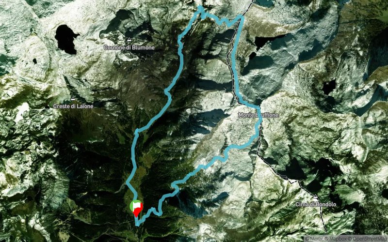


15.7 km
1360 m
1360 m
 Brione (IT)
percorso che proverò settimana prossima mercoledì 14/08/2019
Points of Interest table
| Accum. | Intermediary | |||||||
|---|---|---|---|---|---|---|---|---|
| POI | Description | Alt. | Dist. | D+ | D- | Dist. | D+ | D- |
Trace n°94363
Ascent threshold : 3 m Distance threshold : 30 m Smoothing : Yes Origin of altitudes : MNT Aster GDEM
Ascent threshold : 3 m Distance threshold : 30 m Smoothing : Yes Origin of altitudes : MNT Aster GDEM
Loop
Dominant terrain : Road
Max alti. : 2644 m
Avg alti. : 1968 m
Min alti. : 1462 m
Longest ascent : 1310 m
Longest descent : 1210 m
Route completed by the author : Yes
Dominant terrain : Road
Max alti. : 2644 m
Avg alti. : 1968 m
Min alti. : 1462 m
Longest ascent : 1310 m
Longest descent : 1210 m
Route completed by the author : Yes
Elevation profile
More tools
Create a new roadbook page
Map and track on your website
Warning ! When you insert a Trace de Trail map on your website, you agree not to hide any element of the module (links to Trail Trail or Trail Connect banner)
Add a realisation
Validate
Add a realisation to share your chrono and describe the conditions that you encountered during you trail running !
Add a comment
Validate
Plutomax68
23/08/19, 18:18:23
Percorso fatto, ma percorribile di corsa solo dal Gaver fino al Bivacco del Blumone e al Passo Serosine ( circa 7,8 Km con 1000 mt di dislivello ): poi fino al Passo Diciotto e Cima Bruffione si deve camminare prestando attenzione al percorso ( pietraia grossolana ). Si ricomincia a correre dal 14 km in discesa fino al punto di partenza.
Show the infos
Add a track


