Show the map
Gardiole - Pioch de Camille - Pioch Noir
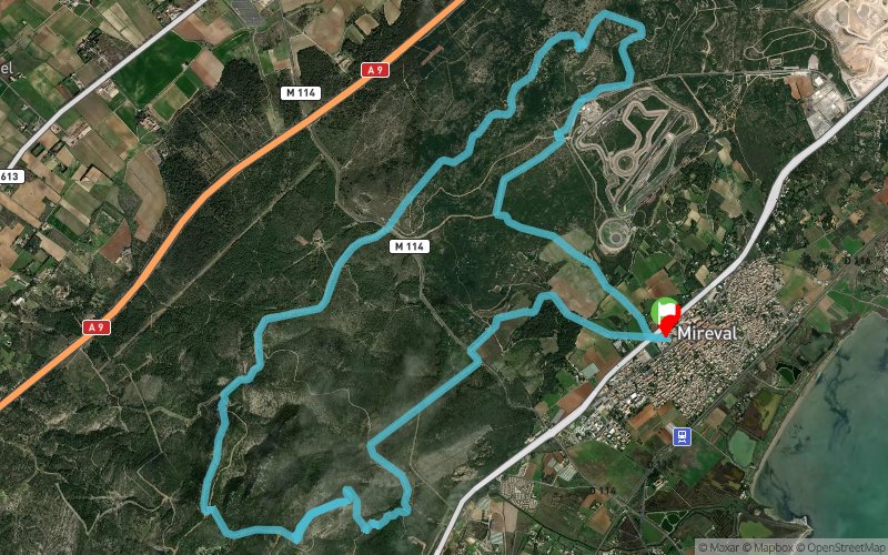


18.6 km
390 m
390 m
 Mireval (34)
 Points of Interest table
| Accum. | Intermediary | |||||||
|---|---|---|---|---|---|---|---|---|
| POI | Description | Alt. | Dist. | D+ | D- | Dist. | D+ | D- |
Trace n°64078
Ascent threshold : 10 m Distance threshold : 0 m Smoothing : No Origin of altitudes : TrailConnect iOS (baro) - GPS
Ascent threshold : 10 m Distance threshold : 0 m Smoothing : No Origin of altitudes : TrailConnect iOS (baro) - GPS
Loop
Dominant terrain : Footpath
Max alti. : 208 m
Avg alti. : 100 m
Min alti. : -5 m
Longest ascent : 190 m
Longest descent : 150 m
Route completed by the author : nc
Dominant terrain : Footpath
Max alti. : 208 m
Avg alti. : 100 m
Min alti. : -5 m
Longest ascent : 190 m
Longest descent : 150 m
Route completed by the author : nc
Elevation profile
More tools
Create a new roadbook page
Map and track on your website
Warning ! When you insert a Trace de Trail map on your website, you agree not to hide any element of the module (links to Trail Trail or Trail Connect banner)
Add a realisation
Validate
Add a realisation to share your chrono and describe the conditions that you encountered during you trail running !
Add a comment
Validate
Micaël Bricaud
24/12/18, 19:04:35
Merci Christophe pour cette trace. N'étant pas de la région, cela m'a changé de mon parcours habituel au départ du parking de la tortue dans le massif de la Gardiole.
24/12/18, 19:04:35
Merci Christophe pour cette trace. N'étant pas de la région, cela m'a changé de mon parcours habituel au départ du parking de la tortue dans le massif de la Gardiole.
Show the infos
Add a track


