Show the map
Croix du Bésot - Les Échevins
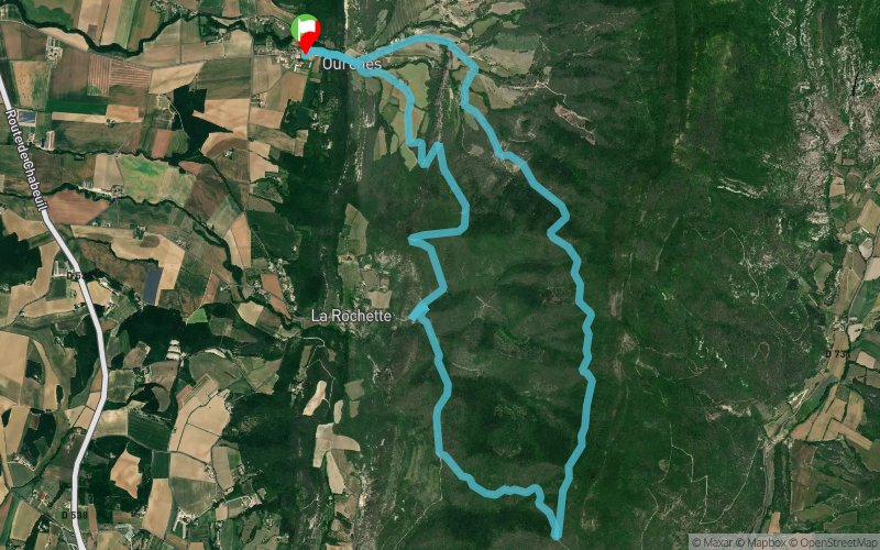


11.2 km
488 m
488 m
 Ourches (26)
 Points of Interest table
| Accum. | Intermediary | |||||||
|---|---|---|---|---|---|---|---|---|
| POI | Description | Alt. | Dist. | D+ | D- | Dist. | D+ | D- |
Trace n°6186
Ascent threshold : 3 m Distance threshold : 30 m Smoothing : Yes Origin of altitudes : MNT Aster GDEM
Ascent threshold : 3 m Distance threshold : 30 m Smoothing : Yes Origin of altitudes : MNT Aster GDEM
Loop
Dominant terrain : Path
Max alti. : 633 m
Avg alti. : 483 m
Min alti. : 327 m
Longest ascent : 334 m
Longest descent : 244 m
Route completed by the author : nc
Dominant terrain : Path
Max alti. : 633 m
Avg alti. : 483 m
Min alti. : 327 m
Longest ascent : 334 m
Longest descent : 244 m
Route completed by the author : nc
Elevation profile
More tools
Create a new roadbook page
Map and track on your website
Warning ! When you insert a Trace de Trail map on your website, you agree not to hide any element of the module (links to Trail Trail or Trail Connect banner)
Add a realisation
Validate
Add a realisation to share your chrono and describe the conditions that you encountered during you trail running !
Add a comment
Validate
Captain
29/07/20, 11:24:03
J'y suis passé il y a peu. Le chemin existe toujours mais assez raviné avec les orages et plus encombré par la végétation l'été.
29/07/20, 11:24:03
J'y suis passé il y a peu. Le chemin existe toujours mais assez raviné avec les orages et plus encombré par la végétation l'été.
JProcu
29/07/20, 10:13:16
Il semblerait que le chemin après le 8ieme km n'existe plus... A déconseiller si vous n'êtes pas un sanglier
29/07/20, 10:13:16
Il semblerait que le chemin après le 8ieme km n'existe plus... A déconseiller si vous n'êtes pas un sanglier
More comments
Show the infos
Add a track


